United Nations issues 'urgent' Super El Niño warning and shares how long it will last
Topics: Weather, Climate Change, Environment, Science, News, World News
Topics: Weather, Climate Change, Environment, Science, News, World News
The World Meteorological Organization (WMO) has warned the world to prepare for the imminent Super El Niño, which is predicted to be the strongest in decades.
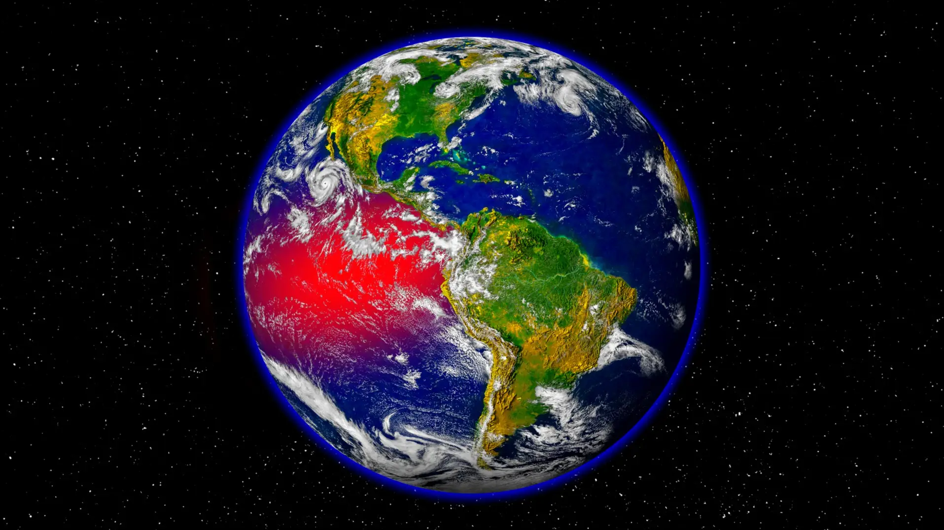
For those who are unfamiliar with the term, El Niño is an abnormal weather pattern that’s caused by the warming of the Pacific Ocean near the equator, off the coast of South America.
A switch in wind patterns allows the warmer-than-usual water temperatures to spread through the central and eastern tropical Pacific, driving extreme weather worldwide.
While we’ve dealt with El Niño events before, scientists and expert bodies think this one could be unusually powerful.
Advert
The WMO and the United Nations today issued their warning that there’s now an 80% likelihood of an El Niño event occurring during June and August 2026, and it’s 90% likely to continue until at least November.
UN Secretary-General António Guterres said in a video statement: “The science is clear: El Niño is arriving on our doorstep in the coming months with 90% certainty.
“The world must treat it as the urgent climate warning it is. El Niño conditions will pour fuel on the fire of a warming world.”
He added: “Impacts will hit even harder, travel even farther, and cross borders with devastating speed.
“The only effective response is climate action equal to the crisis - ending the addiction to fossil fuels, accelerating the shift to renewables, protecting the most vulnerable, and delivering early warning systems for all.”
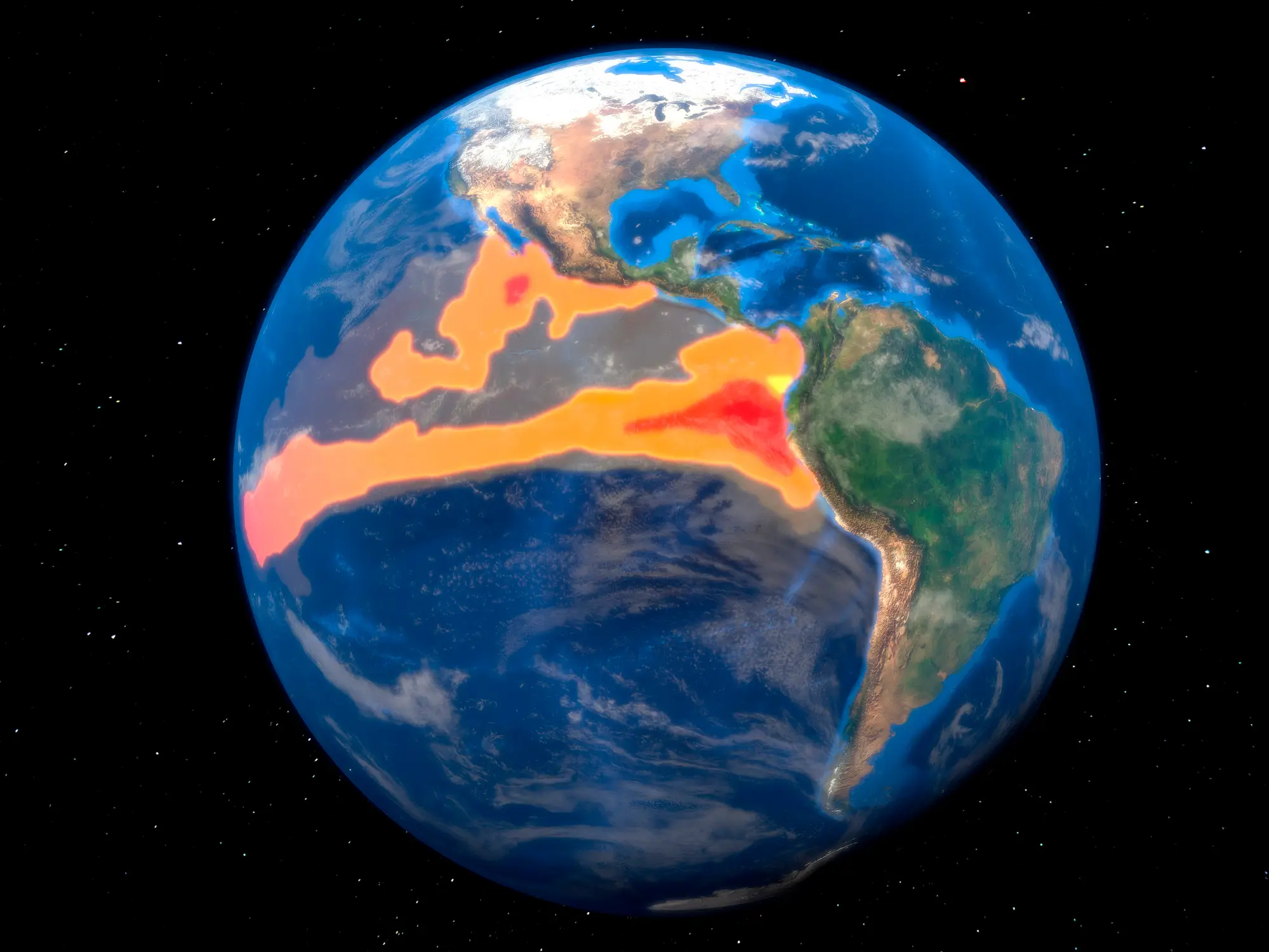
WMO outlined that last month, the sea-surface temperature in the central-eastern Equatorial Pacific was approaching El Niño thresholds, according to observations from different platforms used by the organisation.
The organisation explained that the increasing surface anomalies are being ‘fed by unusually warm subsurface conditions across the tropical Pacific,’ with temperatures exceeding 6 °C above average and ‘providing a substantial reservoir of heat that is contributing to the observed surface warming’.
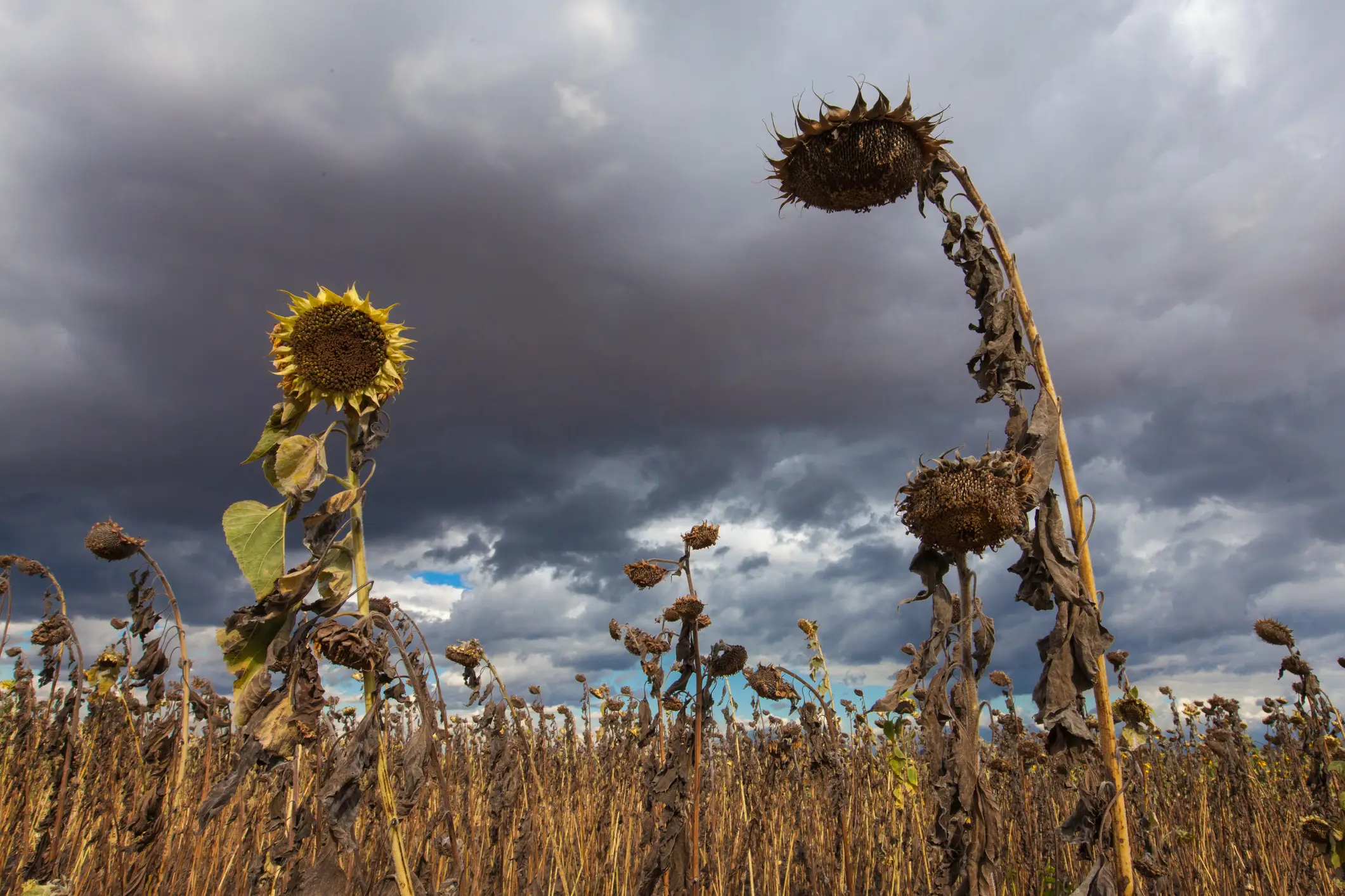
WMO Secretary-General Celese Saulo has warned that the world needs to prepare for a ‘potentially strong El Niño event, which will exacerbate drought and heavy rainfall and increase the risk of heatwaves both on land and in the ocean’.
The most recent El Niño, which took place between 2023 and 2024, was one of the five strongest on record, and it played a role in the scorching global temperatures we saw in 2024.
Saulo added: “The WMO community will be carefully monitoring conditions in the coming months to inform decision-making by governments, humanitarian agencies, and climate-sensitive sectors.
“Advance seasonal forecasts and early warnings are vital to save lives and cushion the impact on our economies and our communities.”
While Professor Adam Scaife, head of monthly to decadal prediction at the UK Met Office, told the BBC: “We're very confident that there's a big event coming. It may even be a record event.”
Strap in, folks. It’s time for some science.
It all starts with something called trade winds, which are permanent winds around the equator which usually blow from east to west. So in the equatorial Pacific, they blow from the Americas towards Australia and New Zealand.
As the wind blows the water east, it is warmed by the sun, so by the time it gets to the other side of the Pacific, the warm water causes hot air to rise, leading to warm, wet and unsettled weather. Meanwhile, colder water from deeper in the ocean rises in the east to replace the water blown west.
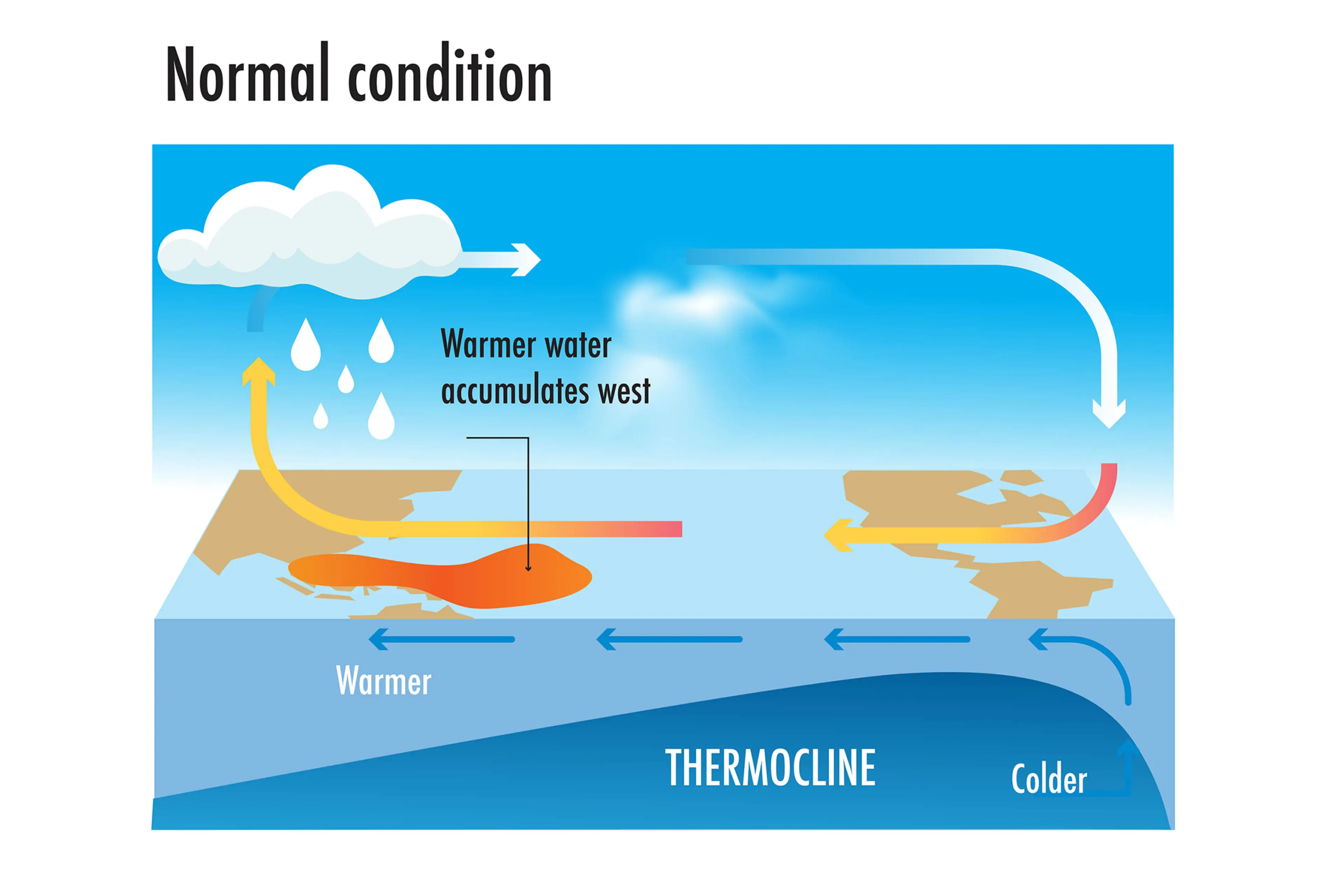
But during El Niño years, this gets disrupted.
When trade winds are weakened or even reversed, the temperature difference between the east and west is cancelled out, and usually cold parts of the ocean warm up.
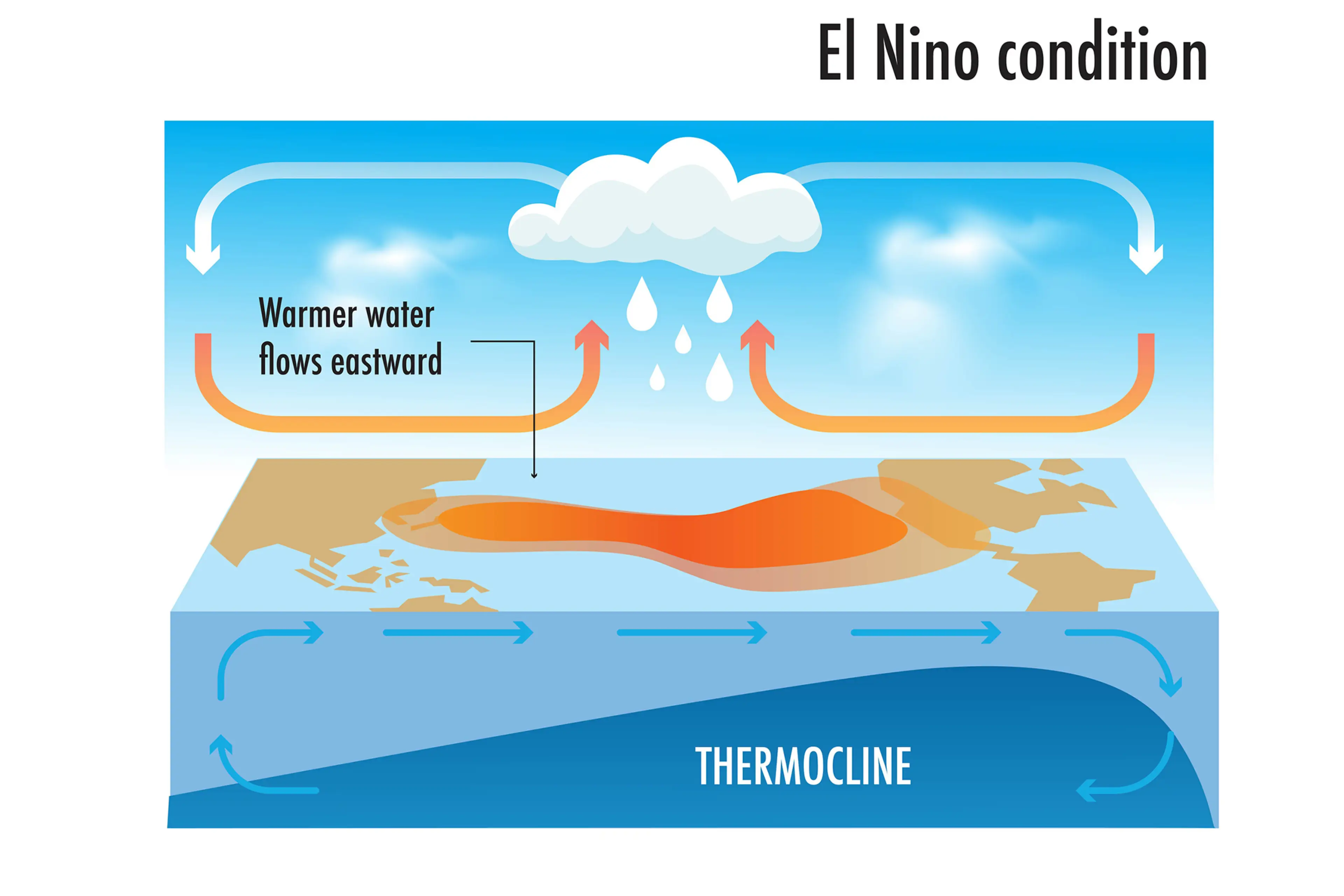
Rainfall and wind patterns change across the equatorial Pacific, which has a knock-on effect around the world.
Anyone else's head hurt a bit?